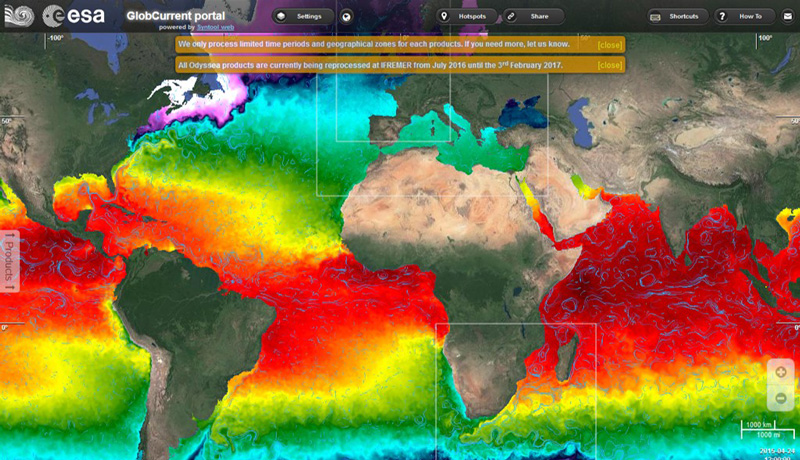
The Globcurrent project of the ESA (European Spatial Agency) has merged the different measurements to generate an image of the daily sea currents during the last 24 years. Shipping companies may use this information to understand the characteristics of surface circulation in certain regions and obtain data in near real time, so that they can choose a route taking advantage of the most favorable currents and reducing the fuel consumption of ships. According to the ESA and data from CMA-CGM on the Europe-Asia route, the use of ocean forecasts could contribute to a cost reduction of close to 0.4%.
For more information, you can visit the website of the European Space Agency (www.esa.int) and its communications section and the official website of the GlobCurrent project: www.globcurrent.org/.
0 respuestas en "Globcurrent, optimization of maritime routes based on real-time data of ocean currents"